
Mapping Software
 Trimble TerraSync
The TerraSync™ software is powerful field software, designed for fast and efficient data collection and maintenance. Teamed up with a supported Trimble® GPS receiver and a field computer of your choice, it's all you need to capture high-quality data for informed decision making.
 Trimble GPScorrect
The Trimble® GPScorrectTM extension for ESRI ArcPad software lets you take full control of your Trimble GPS receiver, and adds the power of differential correction.
 ESRI ArcPad
ESRI® ArcPad® is designed for GIS professionals who require GIS capabilities in the field. It gives field-based personnel the ability to capture, edit, analyze, and display geographic information easily and efficiently.
 Trimble Pathfinder Office
The GPS Pathfinder® Office software is a powerful and easy-to-use software package of powerful GNSS postprocessing tools, incorporating the new Trimble® DeltaPhase™ differential correction technology, ensuring your data is consistent, reliable, and accurate.
 Trimble GPS Analyst
The Trimble® GPS Analyst™ extension for ESRI® ArcGIS® Desktop software will streamline your workflow and improve your productivity by enabling you to work directly with GPS data inside your personal geodatabase.
 ESRI ArcGIS
ESRI® ArcGIS® helps organizations deliver GIS capabilities and data from centralized servers to a range of mobile devices. You can use ArcGIS Mobile to deploy intuitive and productive mobile GIS applications to increase the accuracy and improve the currency of GIS data across your organization.
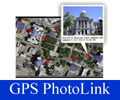 GeoSpatial GPS-Photo Link
GPS-Photo Link is software that maps your photos. Share geotagged photos, data, and maps between organizations. Since 2001, thousands of mapping professionals have been using GPS-Photo Link.
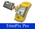
The Trimble® TrimPix™ Pro system provides the tools to take high-resolution photos with a digital camera and wirelessly transfer them in real-time to a Trimble® Windows Mobile handheld for seamless integration into your field data collection workflow.
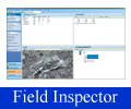 Trimble Field Inspector
Trimble® Field Inspector solution is a robust handheld maintenance and inspection solution for optimizing utility field operations. Scalable and easy to deploy, the Trimble Field Inspector solution automates a wide variety of field applications for electric, gas, water, and wastewater utilities—from smart meter deployments to routine asset maintenance inspections.
 Hydrant Inspector
Trimble® Hydrant and Valve Inspector solution for American Flow Control (AFC) allows water utilities to scan a barcode affixed to all new AFC hydrants and valves, including the Waterous and American Darling, recording the exact specification of the hydrant or valve while capturing its precise GPS location at the time of installation in the field.
 Daumate Geomatics Expert Systems
Datumate’s products are revolutionizing “field-to-plan” processes for land surveying, civil engineering and architectural applications, providing at least a threefold increase in productivity and cost reduction. Datumate’s products serve both private land surveying firms as well as national mapping agencies, allowing them to execute and process their land surveying works easier, faster, cost effectively, and with enhanced quality.